I have just completed a contract for ABI Wildlife Consultancy (operated by a friend and ex-colleague - Abbie Paterson) to digitise some phase 1 habitat survey maps of three campuses at Edinburgh Napier University. One issue I came across was how to set up standard thematic displays of the habitat types according to the JNCC colour scheme for Phase I survey. I eventually found an ArcGIS style file on the JNCC website, but I wonder if anyone else has come across this issue and has either found one for other software or has developed one themselves?
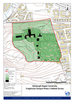
Example of Phase I Habitat Map
 RSS Feed
