- Home
- Croft Mapping
- Habitat Mapping
- East Sutherland Participative GIS
- Dunnet & Canisbay PPGIS
- GIS Training
- MSc in GIS
- Photography
- Iain Turnbull
- Contact Us
Croft Mapping

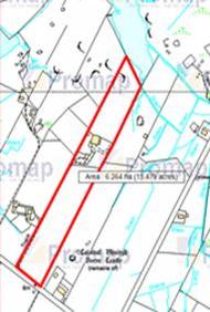
With the advent of the new map-based Register of Crofts in November all crofters will over time be required to have a map produced for their croft. The new register will be maintained by the Register of Scotland and the requirement to have a map produced will be triggered by any application to the Crofting Commission for regulation, e.g. assignation, apportionment, decrofting, sub-division, etc. Recently the Commission have indicated that all common grazings will be mapped and clerks will be receiving maps from the Commission showing their best estimate of the boundaries of their grazings. Crofters will be required to respond with any comments or alterations and these will be agreed and digitised by the Commission.
Rural GIS offers a croft mapping service at competitive rates starting at £50 per map (not including OS map data), depending upon the scale of the job and the information available. Rural GIS can also survey the boundaries of a croft on the ground and assist with dispute resolution, or offer a township level mapping exercise which sets out the boundaries of all crofts, grazings, access routes, apportionments and de-crofts. Township plans offer enormous scope to assist in the management of crofts, grazings and other communal facilities, planning for release of land for development, e.g. housing, access, renewable energy schemes, crofter forestry, etc.
For a formal quote please contact Iain at Rural GIS or call 01599 566332.
