- Home
- Croft Mapping
- Habitat Mapping
- East Sutherland Participative GIS
- Dunnet & Canisbay PPGIS
- GIS Training
- MSc in GIS
- Photography
- Iain Turnbull
- Contact Us
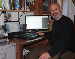
Iain Turnbull - Qualifications & Experience
|
Iain is a Chartered Geographer who has a wide range of experience in GIS, ecology, estate management and planning. He has extensive knowledge of crofting systems and administration and management planning.
Qualifications: Chartered Geographer (GIS) since October 2012 Graduated with an MSc with Distinction in Geographical Information Systems (Online Distance Learning) at the University of Southampton - 1st July 2011 Fellow of the Royal Geographical Society since June 2011 MPhil - University of Edinburgh 1993 BSc Ecological Science - University of Edinburgh 1986 |
Previous Experience
Property Manager - Balmacara Estate - National Trust for Scotland - 1996-present Senior Management Planner - National Trust for Scotland - leading a team of planners working across Scotland - 1992-96 Research Assistant with Habitat Scotland/Skye Forum - working as part of a small team on the Resource Data Atlas of Skye - 1990-91 Seasonal Countryside Ranger at Inverewe (National Trust for Scotland) including guided walks, talks and survey & monitoring of species & habitats - 1986 Work experience has included:
Over 10 years experience of GIS using MapInfo Professional and ArcGIS Management plans for: Balmacara, Canna, Iona, Kintail & West Affric, Torridon, Preston Mill, The Hill House, Leith Hall Policy work: NTS Crofting Policy, co-ordination of NTS response to Crofting Law Reform Management and administration of a crofting estate Planning & supervision of a range of surveys: Balmacara Estate NVC survey; Balmacara Woodlands BBS; Drumbuie, Duirinish & Plockton CBC Management of the Balmacara Square Housing Project Creation and management of the Balmacara Estate Traditional Croft Management Scheme |

