Skye & Lochalsh Environment Forum's Mink Project
Rural GIS undertook some basic data manipulation and mapping for Skye and Lochalsh Environment Forum who had succeeded in obtaining funding from Leader, Highland Council and Scottish Natural Heritage to undertake a monitoring programme in the Skye and Lochalsh area in 2010-11. The aim of the project is to find the distribution of mink throughout the area and to assess the scale of the impact on the local wildlife and domestic stock.
Over 80 volunteers monitored clay pads situated in 55 tunnels and rafts across the area between August and November 2010. The paw prints of mink moving across the clay pads were recorded either weekly or fortnightly and null reports were also recorded. Tunnels and rafts were distributed from Point of Sleat in the south of the area to Staffin in the north, and from Arnisdale, Shiel Bridge and Stromeferry in the east to Roag in the west. The tunnels and rafts were initially anointed with a musk lure containing extracts from anal glands of captured mink and sourced from the USA to encourage mink in the area to investigate the clay pads. This was renewed after six weeks. Reports of sightings and damage to poultry and livestock were also collated to provide a more complete picture of the distribution of mink. The results indicate a widespread presence of mink across Skye and Lochalsh, including Island populations on the Crowlins and Rona.
Further details of this project are available on the Skye & Lochalsh Environment Forum's website at: www.slef.org.uk/american_mink.html
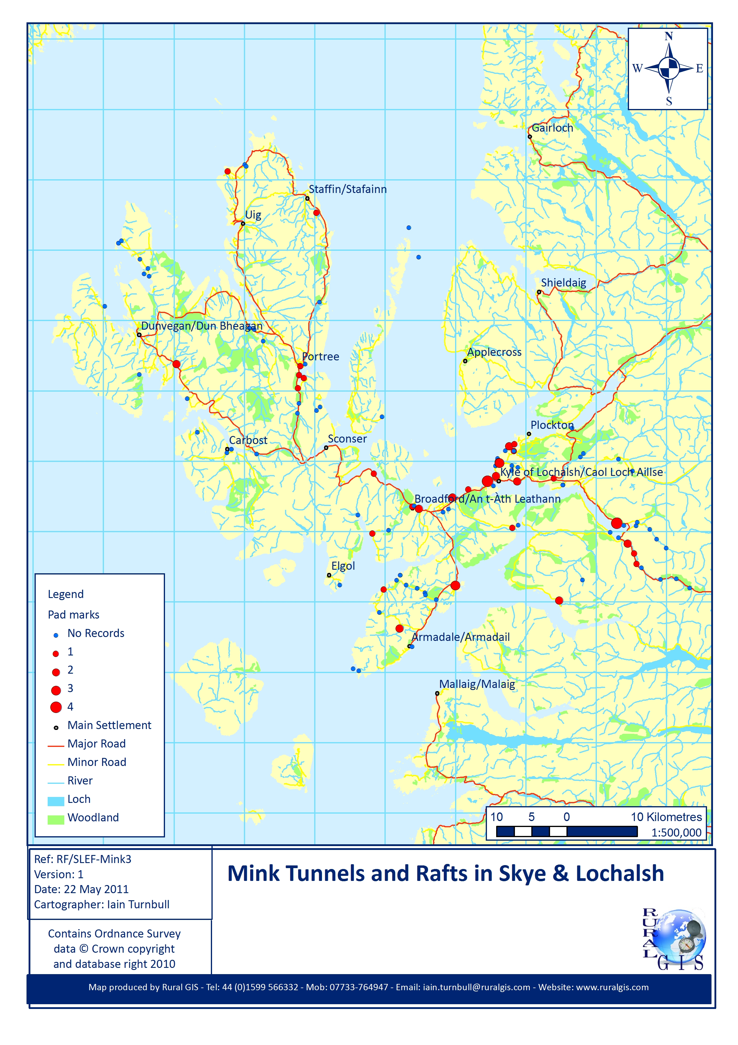
Map of mink tunnels & rafts in Skye & Lochalsh
